Release notes
2026.04.10
- Balloon Navigator is now available in multiple languages: Czech, German, English, Spanish, Finnish, French, Hungarian, Italian, Japanese, Korean, Lithuanian, Dutch, Polish, Portuguese, Romanian, Russian, Slovak, Slovenian, Swedish, Turkish, Chinese.
- Go to Settings -> Interface to change language
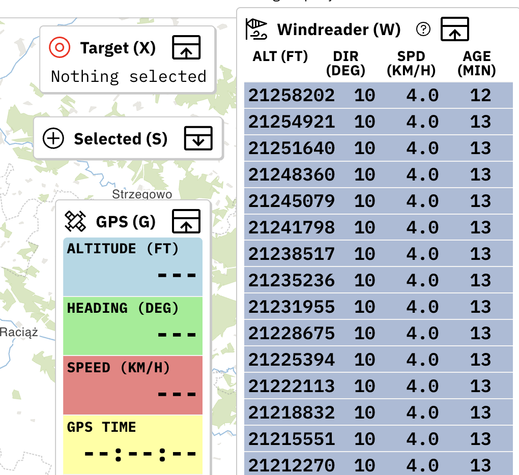
- Added Variometer and Magnetic Heading to GPS panel
2026.04.01
- Live Sharing - create public link to share your position with others. Read more
2026.03.31
- Map server upgraded to new machine on fiber connection - map downloads should be much faster now
- GPS simulator has option to set initial altitude on start
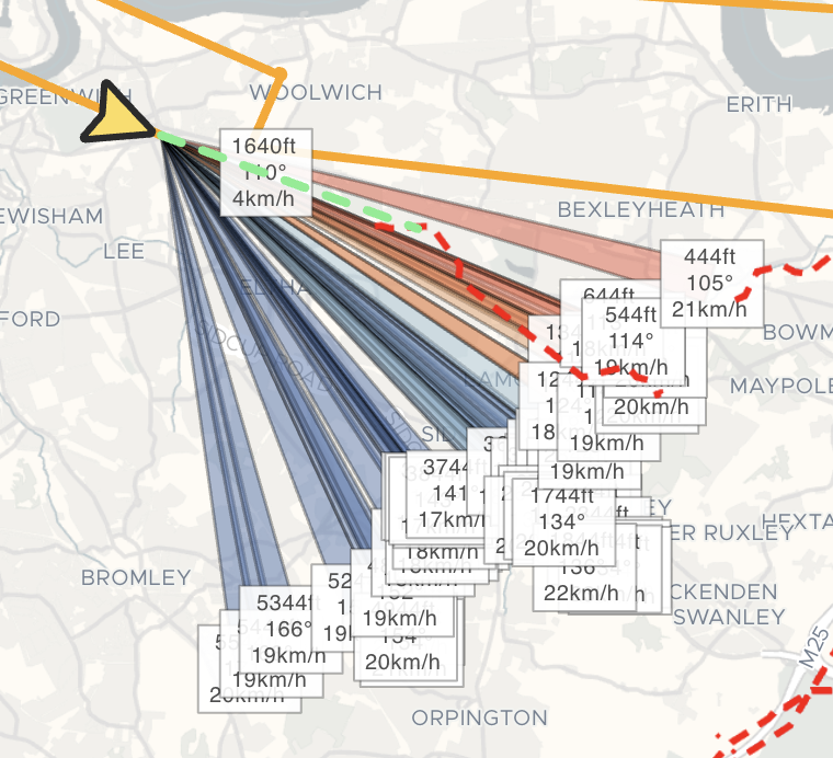
- Best result point is now displayed on map for selected and targeted waypoints
2026.03.25
- Added Wind Sectors to quickly visualise all wind readings on the map. Read more
2026.03.24
- Windreader can import Windwatch files in .csv, .dat or .txt format
- Wind data sources can be filtered, ex. All sources, Only me or single source like Live Tracked pilot or import.
2026.03.19
- Added UTM grid map layer
2026.03.15
- Extensions API reworked to use JSON RPC specification (breaking change)
- Extensions can register custom panels, similar to Windreader or Selected
- Adding custom windreading supports user altitude units
- Double clicking waypoint on map opens edit window
2026.03.11
- App has been redesigned with brand new, custom user interface
- Keyboard shortcuts have been updated
- New Quick Add menu to quickly add waypoints
- Waypoints, Tracks and Import unified under Data
2025.09.18
- Added option to always snap waypoints to 10m UTM grid (Settings -> Interface)
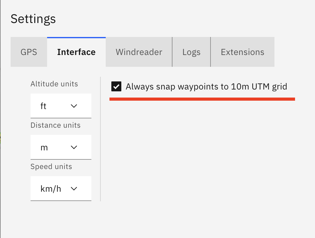
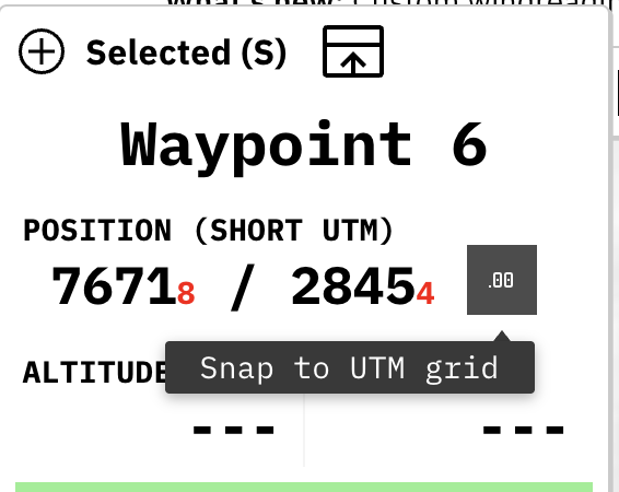
- If waypoint is not exactly on 10m UTM grid, Selected panel will show it with red numbers at waypoint position and allow you to snap waypoint with a click of a button
2025.09.13
- Custom readings can be added to Windreader by manually providing altitude and bearing. Click on “Add custom windreading” button on Windreader panel to use it
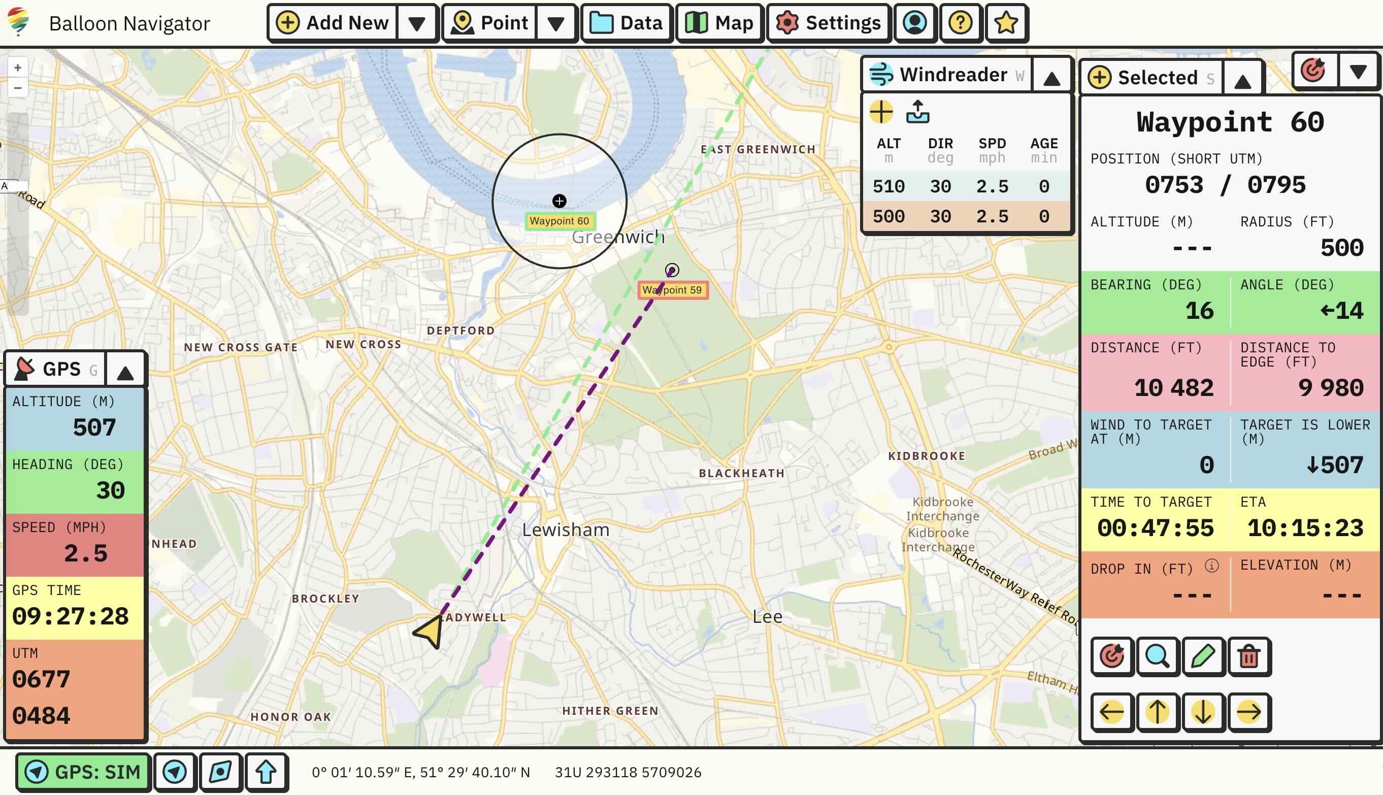
- Added arrow buttons to Selected panel, now you can click on them to move waypoint around on the map
- Waypoints list now allows to select multiple (or all) rows and manipulate them. Available options are Show, Hide and Delete
- Fixed waypoints deletion not being propagated to sync, which caused them to be synced back from server, effectively preventing any waypoints from being deleted when sync was active
- Improved waypoints and tracks sync performance
2025.08.15
- Added satellite imagery map layer (enable in Maps -> Layers)
2025.05.27
- Panels are bigger and have better support for touch interaction
- Panels can be moved around on the screen and remember their positions
2025.05.07
- Added Hillshading layer to visualise elevation changes on the map. Can be enabled in Map -> Layers

2025.04.25
- World-wide elevation data for Pro users. Use online for every map or download custom offline maps with elevation data included automatically.
2025.04.15
- Tracks can be replayed with GPS Simulator (option in Tracks List menu)
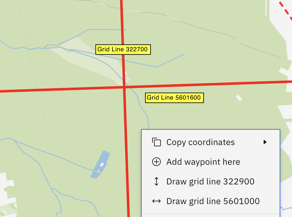
- UTM grid lines can be drawn using map context menu
2025.04.08
- Improvements to GPS Simulator: added climb rate and heading change over time
2025.04.06
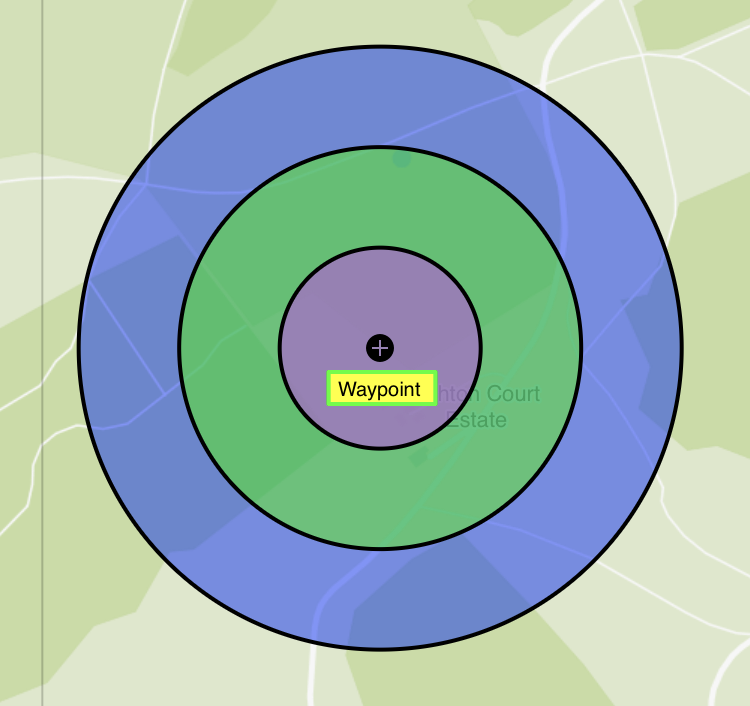
- Draw Task Rings - draw additional rings on top of waypoints (see docs)
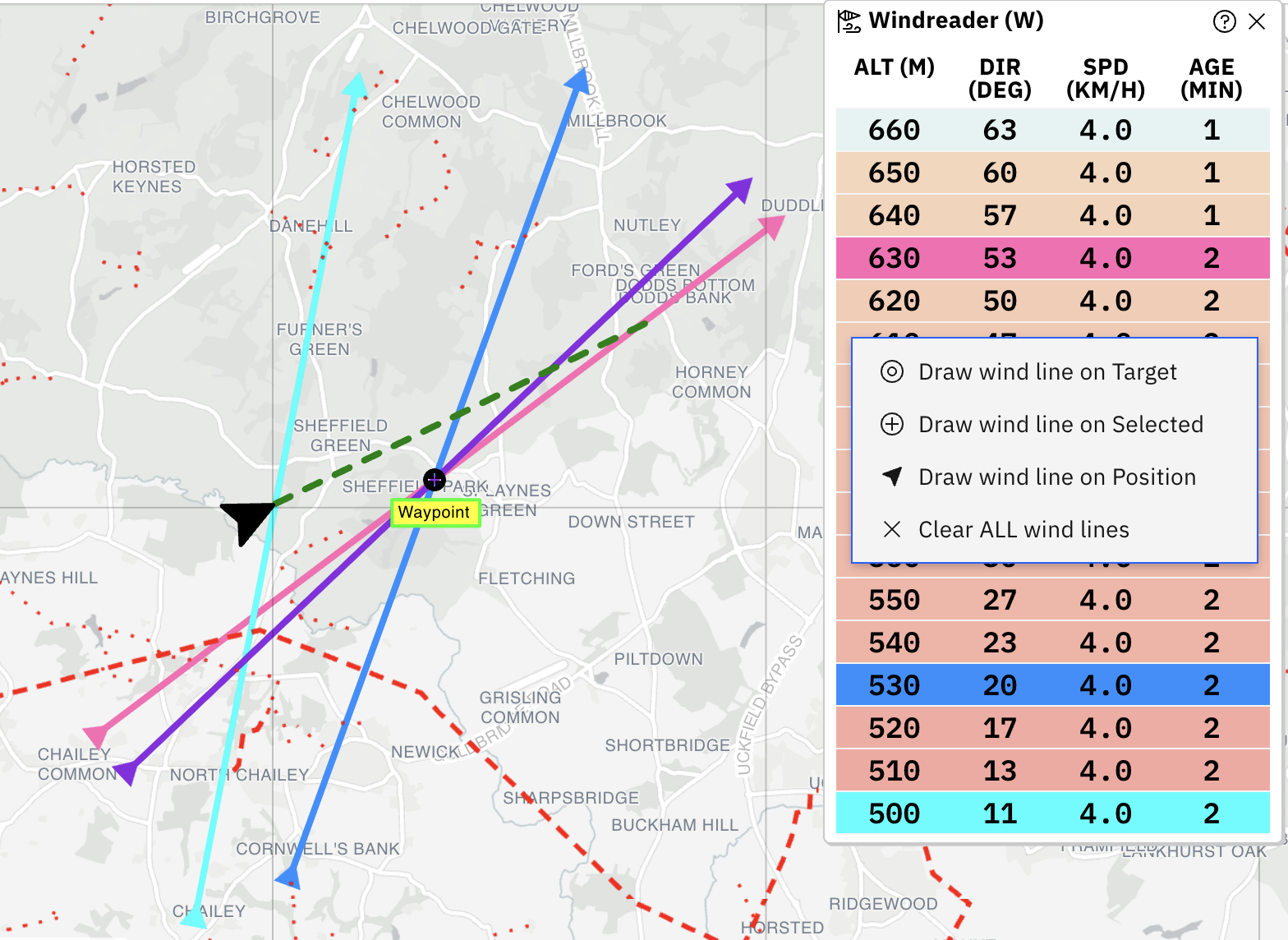
- Draw Wind Lines - draw wind lines on the map by clicking on recorded measurements in Windreader (see docs)
- Move waypoints - waypoints can be quickly moved on map by 10m or 100m in four cardinal directions using arrow keys (see docs)
- Copy and paste waypoints - added context menu (right click menu) on map with options to copy coordinates, copy/paste/delete waypoints and more
- Improved search in waypoints list and tracks list. Now they can be searched by everything: coordinates, altitude, distance etc.
- Selected/Target waypoint data such as position, altitude and radius have improved formatting
- Green line marking forward direction is now dashed
2025.03.30
- Added support for custom waypoint styles
2025.03.26
- Windreader is synced between live tracked pilots (see docs)
2025.03.25
- Added option to change display units of altitude, distance and speed.
2025.03.14
- Added Graticule (coordinate grid lines) to map layers
- Windreader has different color based on altitude difference
2025.03.13
- Reworked right sidebar into drag and drop, hideable panels
2025.03.09
- Maps can now have four different visual styles (see documentation)
- Added selectable map layers to show/hide additional map data (see documentation)
2024.11.08
- Added experimental extensions support (see documentation)
2024.07.02
- Fixed import/export bugs on iPad
2024.06.14
- Improved displaying circles on the map:
- Center of circle is marked with crosshair, just like Points
- Radius is shown for every circle
2024.06.06
- Added experimental Live Tracking (see documentation)
- Improved visuals on data panels, selected waypoints and footer: more colors, better contrast, bigger buttons, bigger font on values and changed how some values are displayed
- Windreader now shows speed in km/h
- Fix to waypoint altitude being entered in feet, but displayed in meters
- Data panels are pushed to right side on mobile
- Changed sidebar manual open button icon and added popover tooltip
2024.05.20
- Updating short UTM coords now replaces last digit of full UTM coords with zero
- Fixed coordinate values not updating properly on changes when creating new waypoint
- Bug fixes to Balloon Live Sensor data parsing
2024.05.19
- Added support for mobile phones
- Fixed overlapping UI elements and incorrect positioning
- On phones in portrait mode (tall and narrow screen), selected waypoints are moved from right sidebar to lower third of the screen
- (some menus are still not yet optimized for mobile)
2024.05.14
- Added user accounts and automatic sync of waypoints and tracks between logged in devices
- Fixes to interface: footer with GPS button is visible when left sidebar is expanded
- Various bug fixes