Balloon Navigator

Tested by competition pilots flying in World Championships
Standard features and maps will always come free - all pilots deserve proper navigation
Balloon Navigator does not require an internet connection to work and you can download maps offline without limits. You don't even need an account, just open the app and fly.
Use the world map online or download parts of it offline. No calibration is required. All maps come with additional data, such as power lines. World-wide elevation data is included for Pro users.
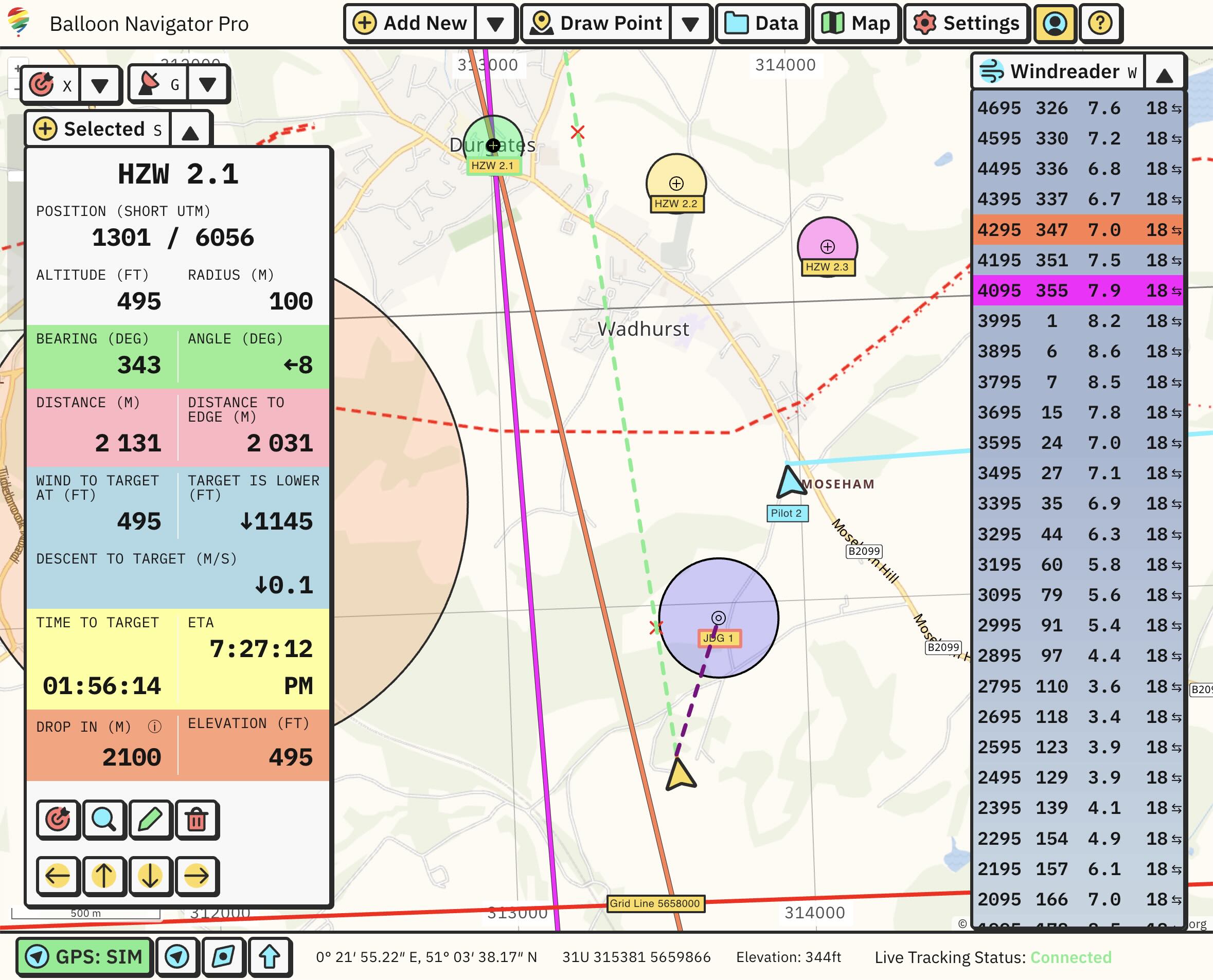
Track wind direction and speed at every altitude you've been to and quickly draw windlines on the target or your position.
Fly as a team and see each other on the map, together with navigation data such as altitude, speed and heading. Windreader data is shared between connected pilots.
Based on your speed, altitude and elevation, Balloon Navigator will calculate the marker path to the ground and tell you the exact moment to drop it for the best results.
One-click waypoint and track import from OziExplorer, GPX, KML and GeoJSON.
Create an optional account to backup your settings and waypoints online, and sync them between multiple devices.
Powerful API to access Balloon Navigator internals. Create custom features, interface elements or flight calculators exactly as you need them.